


The Border as River, Wall, Market
Reflections on Two Trips to the Texas-Mexico Border

My next book is out August 5th. If you’d like a free copy, become an annual supporter, and get the book, plus all the usual benefits. Check it out here.
To live in Texas is to live in a state with at least six distinct regions, and Abilene belongs to none of them. It’s too far West to count as Central Texas, thankfully too distant from Dallas to be part of the sprawl. It’s too far South to be truly counted among the high plains of Amarillo and Lubbock, too far East to have much in common with Odessa or Midland, much less El Paso.
By being closest to West Texas, Abilene knows some things unavailable to other areas of the state. But it knows nothing much of the border. Abilene is, at its closest point, six hours from the Texas border. To get there, you must either drive 456 miles to El Paso, or four hours to San Antonio, at which point you are still just over halfway into the journey.
The border, in Texas mythology, is the hinterlands, the unruly area bisected by the Rio Grande River, and only made possible because two separate countries refuse to be torn apart. Like lovers under moonlight, Mexico and South Texas discretely and overtly parade their love, fusing two discrete countries over and over again, while the rest of Texas pretends that Romeo and Juliet are kept far apart by their parents.
It is the open secret that this dynamic of union has always been the story of the South Texas border, and much of this goes back to the unwieldy way that parts of Mexico became incorporated into the United States. James K. Polk, elected president in 1844, had made part of his platform the connecting of the American frontier with California and Oregon, and that meant incorporating part of Mexico that, at that point, were keeping the United States divided in two. In 1845, he made good on that promise, invading Texas and occupying Santa Fe, the regional capital of the Mexican provinces above the Rio Grande. Overnight, an area from Colorado to the Rio Grande was folded into the American portfolio, neglecting the simple fact that the people living there had no reason to think of themselves as anything other than Mexican.
Ever since, Texas and Mexico, in different ways, have had kept up the charade of division that is the Texas-Mexico border. If you visit Brownsville, McAllen, El Paso, or Laredo, you’ll see a Spanish-English culture which freely moves between Targets and tacquerias, cities which have whole pockets in which all signage, stores, and conversations happen as if Polk was still in the future. This is not defiance or some kind of neo-subversion. These neighborhoods are the recognition that borders are moments in history which must now be accounted for, even as the link between Mexico and Texas is the groundwater, the atmosphere, the humidity.
The Border as a River
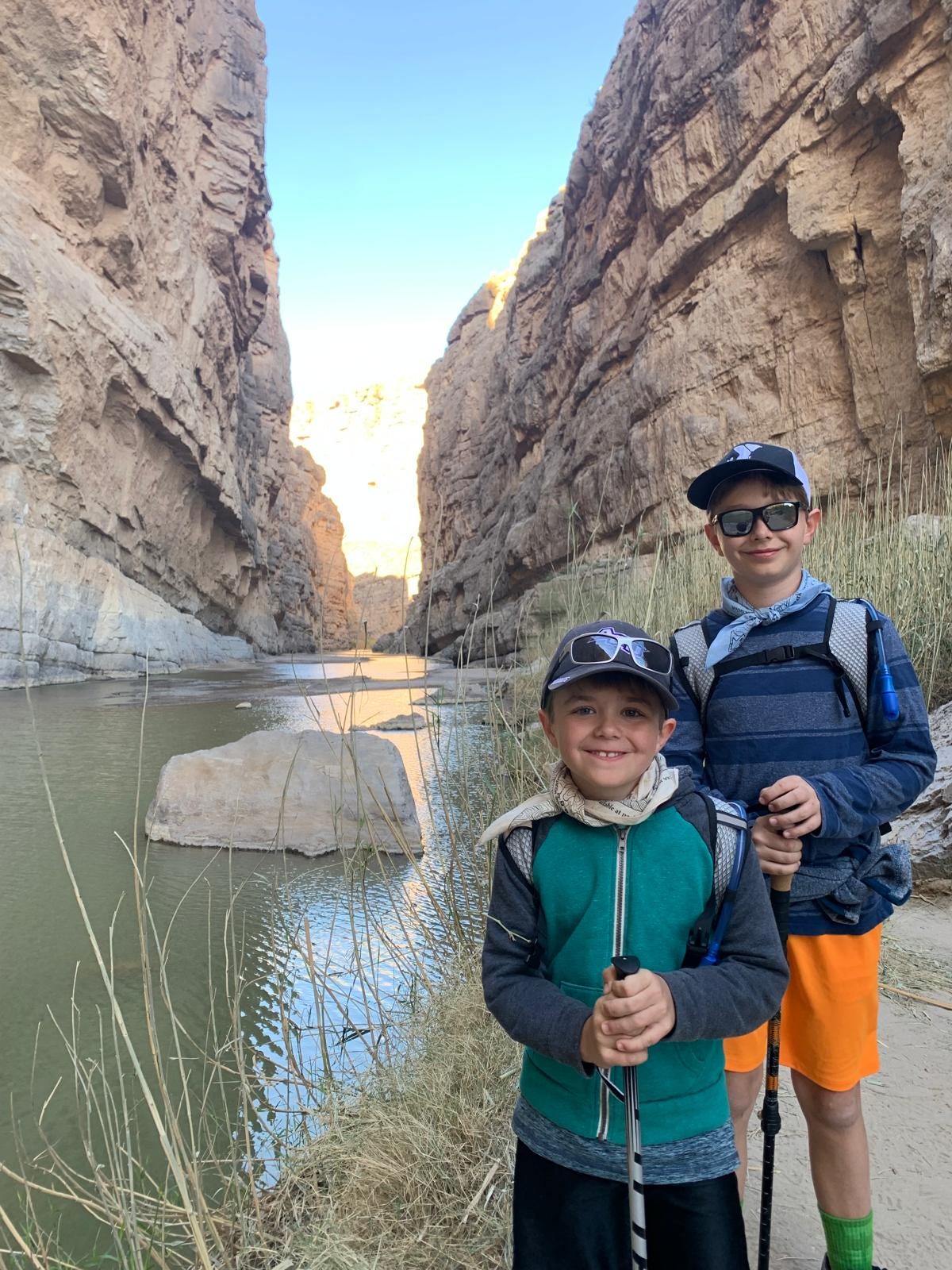
In March 2025, we traveled to the greatest marvel of Texas: Big Bend National Park. The magnitude of the area matches the state, which is larger than 40 other countries1. Big Bend covers over 1,200 miles and shares 118 miles of border with Mexico, much of which is inaccessible except by hiking through treacherous mountain terrain. Nonetheless, CBP trucks could be seen on the highways out of the park, and a checkpoint ten miles north of the west entrance politely asks if you’re transporting migrants.
For anyone who has been to Big Bend, the question of CBP is ridiculous, if only because this area is incredibly inhospitable to flora or fauna or human. Our AirB&B, located fifteen minutes north of the park, functioned on a reservoir of rainwater and dew, the whole area sitting at the top of the vast Chihuhuan desert. Signage consistently reminded visitors to drink the water they brought in, as the pumps in the park could not keep up with the demand. The park itself, as staggering as it is, is largely accessible only by foot, meaning that most of the majesty remained out of our car window as we took the few paved roads through the region. I frequently imagined what it could actually mean for someone to try to traverse any of this land on foot.
For all of its inhospitality, the land provides illumination of how futile the CBP’s efforts were. In two locations, though, the park touches the mighty Rio Grande, where it exists primarily as a trickle, meaning that Mexico and the United States are functionally one. Occasionally, inside the park, the river turns into a four foot meandering river, but nothing approaching ominous, nothing that can’t be floated across. Water disputes between Mexico and the United States means that the Rio Grande, in many places, looks like this. The Colorado River, which feeds into the Rio, has been under stress for decades, and the mighty border river in the park area is among those parts of the larger river paying the price.

In the shadow of the Santa Elena Canyon, you can step across the trickle, walking across the water to touch the far canyon wall, Mexican stone. If you drive slightly out of McAllen, past the Bentsen-Rio Grande State Park, you come to another version of the river, passable by intrepid swimmers, animals, and the occasional night boat. Anzalduas International Bridge is the normie route, but the wildlife cares little for the protocols.
A river is a kind of seam, pulling two sides together by making transparent the land beneath it as the water rises and recedes. The connection the water provides between lands is sometimes almost transparent, letting us in on the joke, making clear the lovers’ kiss which lies beneath the opaque surface. The seam, in drawing together two fabrics, likewise meshes the two fabrics as one. Runoff from Matamoros finds its way into McAllen taps; tourist trash from the Rio Grande Village finds its way into Boquillas. What is forbidden to people politically is truth to the river, truth which is makes clear when the waters are low.
While building a house in McAllen last week, we were told that the lack of people out and about was due to ICE quotas, the aim of deporting 3,000 people every day. What ICE does, beside being immoral in its execution, is in defiance of the river. Many of the homes there are of mixed status, of those who could traverse the river politically, and of those who would be swept away by the politics which the river knows little of. What ICE believes is not believed by the river: people cross and recross, because the river pulls together that which politics seeks to manage in division.

The Border as Wall
In the Santa Elena Canyon, you can walk across to Mexico, put your hand on the cool granite wall, but this is the end of your entrance into Mexico. For at that juncture, the journey into another country would take you up straight up 300 feet into the shade of the canyon. If you want to talk about a border wall, one could do no better than ask nature what this might mean: sometimes no means no, absolutely.
The history of border walls with Mexico is one rife with design oddities2. Most commonly, what you will find is a steel bollard design, not dissimilar from the yellow poles in downtowns. But concrete walls, vehicle barriers, steel mesh, anti-tunneling features, and spiked tops have also featured into various designs. Intrepid opponents continue to find ways through, over, and under the latest protypes. Ladder parts, paragliders, old fashioned tunnels and acetylene torches: Romeo and Juliet will not be rent asunder.
The wall tells another story about migration than the river, one of filtration and selective movement. We imagine most walls to be as solid as the canyon side, but in border walls, not all is meant to be kept out: migratory birds, sand storms, Green Cards—these all pass through. But it is the hope of the wall that fentanyl cannot pass as easily through steel bollards as roadrunners, that a more stringent barrier provides something a river cannot.
Santa Elena is the aspiration for most border walls in popular imagintion: a natural feature as imposing as possible, which creates an impermeable barrier. But this is the luck of nature that Santa Elena exists. For even Santa Elena is an unnecessary last defense, a peak at the top of the Chihuahuan Desert, a wasteland through which thousands of migrants pass and hundreds die annually3. The canyon wall is at the end of an already imposing process.
These high walls, like Santa Elena, are mostly unnecessary, for deterrence to migrants is taken up by more mundane means mostly: grains of sand, economic disincentives, increased ICE budgets. The walls, as imposing as they are, are the afterthought in nature, not the first thought. And of the most grand wall, there is always an end.

The wall, as a more recent invention for managing migration than natural features, knows its limits, precisely because they are overcorrections, unwieldy tools for subtle questions. Throughout the world, we can find walls built of the natural elements at hand: shale from the ground, slag from the shore, timber from the field. But, having been dragged up out of the ground, the walls are always in need of being rebuilt, needing to be put back into motion, unnatural instead of flowing and an overstatement instead of integrated.
The Border As A Market
Sometimes, what is divided by politics is united by water, and calls for us to pay attention to where we divide by politics unnaturally. And sometimes the wall makes clear that no desired division can happen without great effort. But sometimes, migration is less like a natural occurence, and less like wishful overcoming of impediments, and more like an unexpected exchange.
Water does not always flow seamlessly, but sometimes collects, in eddies, in tidepools, places of exchange. This is simply what water does, and, for as long as there has been people to live near the water, what people do. Across from the parking lot of Big Bend, near the Rio Grande Village, there is the village of Bosquillas del Carmen. There is an official checkpoint a mile away, with papers, guards, and tourists, should one want to drink a tequilla internationally. But in the grove of trees, between the parking lot of the park and the river trail, you will find men on horseback, legs wet from the water, with a cash box and handcarved goods. You will find them, in the morning, with sweetbread and no English.
They will disappear frequently and come back on horse, sell their goods, and go back to the village across the hill. No one minds.
Bosquillas del Carmen lives on the travel to the park, and the hopes that some of the half-million visitors to this remote majesty will go a bit further across to Mexico. That there is a makeshift market set up in the park is part of, I think, what you get in this place where two lovers are holding hands under the water. The border creates what both sides of it are in the exchange, in what is let in and kept out, in what is allowed traffic and what is given sanction. But lay markets such as this are there, and perhaps have been there before and after Polk, before and after ICE, through and because of steel bollards.
In these markets—economic and otherwise—ideas and people begin to travel. Languages begin to alter as one world comes into contact with another. Practices of living, eating, and habitation begin to be altered, without official sanction. Such is what happens in the river from time to time, as growth happens in pockets where the land is given time to draw new things into the water, and where the water is given time to deposit its goods. And such is what happens when people are allowed to take their time and give their goods, without anyone giving permission for it to happen.
The Border As God’s Possibility
All of this talk about what kind of image best captures a moral approach to migration can be wishful thinking. But I think, more often, the problem is one of migration being constrained by which discipline is framing the question of migration. The literature on migration and borders proliferates by the year. The approaches which dominate the literature are first and foremost political science, with geography second, religion far behind.
And so, dominated by political science, migration gets treated as a kind of exercise which ignores the subtlety of human movement. This is where, however, theology offers a more dynamic way to view things. For in Scripture, migration is all around. As one of the most fundamental of human actions, why would it not be caught up in the drama of salvation?
Migration begins with the introduction of sin, a fracture of time and place which emerges alongside a fracture between God and humanity. Home is destabilized in time and eternity, and the story of Scripture is one of bearing that rupture. As the first family leave the garden, their children continue the story, with their division from one another repeating a pervasive theme of Scripture which we see in Abraham, the Law, travelers who are incorporated into God’s economy.
The quick appeal to Romans 13 in these conversations mirrors progressive appeals to Leviticus’ openness to strangers. In both instances, attention to migration is short-circuited by an injunction which requires us to no longer to pay attention to what migration is doing. Scripture is more interested in how these injunctions are shorthand for longer stories and histories which describe God’s character and action. And in these stories, motion is on the way to somewhere, namely, God.
Beginning in Genesis, migration is not a departure from God, but a movement which goes alongside God’s economy. Consider Ishmael: having been cast out from Abraham’s tribe, Ishmael’s tribe becomes traveling merchants who transport Joseph to Egypt. Consider Joseph: his movement from Egypt becomes the salvation of his family. Consider Moses: his movement through the desert becomes the salvation of Israel. Consider the Law: the treatment of migrants reflects the long history of Israel. Consider Jesus: God travels at three miles an hour through Israel, that the nations might stream into the temple.
The river, drawing all things to God, shows the divisions to be less than we think they are. And the walls, in God’s economy, are shown to be sometimes unnecessary—what is kept out often times did not want to come in to begin with. And the market too plays its part, creating space for those who do not yet wish to come in to become curious. In the end, it is the Christian hope that all of this movement might find its proper frame, that God—through something as mundane as movement—might be drawing creation into the New Jerusalem, where the gates are always open.
The largest private ranch in Texas, King Ranch, is larger than the state of Rhode Island.
Observe that, even in the 2022 prototypes, there are innumerable low gates. To build a wall endlessly is simply a structural impossibility. Even a Great Wall ends because of the limits of nature, time, and money.
The El Paso sector, linked above, notes that somewhere around 300 migrants were known to have died crossing the Sonoran and Chihuahuan deserts. Known. For a searing read, avail yourself of The Land of Open Graves, an anthropological account of migrant artifacts and the “prevention through deterrence” approach of using the geography of the border as a deterrent.
This post really resonated with me--first as a sentiment and for the theological throughput, but also as a native Texan. Big Bend National Park is truly "God's Country" to me. I too have stood--ankle deep-- in the thalweg of the Rio Grande as it runs through Santa Elena Canyon and reflected on the disparity between the weight of that physiographic boundary as a divide between two countries against it's relative conspicuousness when you stand there in person.
I was fortunate to work under a professor of political and economic geography in graduate school (also in Texas!) who summed it up poignantly: while at a macro-level, the differences on either side of the U.S.-Mexico border may seem stark, at a mirco-level those difference are almost non-existent, resembling instead a cohesive culture and community. I have not only seen that firsthand, but your words here have reinforced this.
(On a side note, I can go overboard with parsing Texas into geographic regions, a la the way Texas Parks and Wildlife segments the state. However, even then, I have also struggled on where to place Abiliene, as well as towns like Brownwood. I guess they've always been the "high plains" to me, though that is probably inaccurate. I will defer to the current or former residents of that region such as yourself!)
Apropos of nothing, I proposed to my wife in Big Bend National Park.